
Introducing OpenSense COST Action on World Meteorological Day
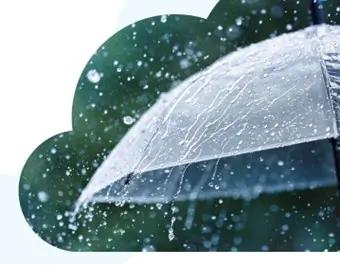
Measurements of precipitation are important for predicting weather. It gives information about the intensity and location of precipitation and its form, for example rainfall or snow. It also contributes to our understanding of long-term climate changes, which helps in predicting future changes. Precipitation plays a crucial role in agriculture, as it directly affects crop growth and production. Accurate precipitation measurements help farmers make informed decisions about planting and harvesting. In addition, precipitation is a key factor in managing water resources. By measuring precipitation, water managers can make decisions about water storage and distribution to meet the needs of communities and ecosystems.
Currently, precipitation is measured using a variety of instruments, including rain gauges, snow gauges, and weather radar. However, the accuracy and coverage of these measurements can be limited, particularly in remote and rural areas. To improve precipitation measurements, there is ongoing research and development of new technologies, such as satellite-based methods and improved ground-based instruments. Additionally, data from multiple sources can be combined to create a more comprehensive view of precipitation patterns.
Operational precipitation observations are also needed in a variety of fields not directly related to the water cycle, such as the management of road traffic, optimisation of wind turbine performance, or the mitigation of propagation impairment of advanced satellite communication systems.
Despite advances in remote sensing, precipitation observations remain one of the weakest links in the description of Earth’s water cycle. This is especially critical in the face of climate change, human-induced hydrologic changes due to rapid urbanisation, and the consequent increase in the frequency and magnitude of extreme events.
The existing available rainfall observations from weather radar and rain gauge networks are, however, not always sufficient, in particular in urban and mountainous areas. In less developed regions, weather radars are often not available at all and gauge networks are sparse.
Opportunistic sensing can greatly improve the spatial and temporal resolution of standard precipitation monitoring networks on a continental scale by complementing them with measurements from personal weather stations or devices primarily not intended for precipitation monitoring, such as commercial microwave links or broadband satellite terminals.
The number of opportunistic sensors has already exceeded the number of traditional in-situ observations by an order of magnitude, and it is increasing exponentially. Nevertheless, it is still unclear how to make this data operationally accessible, achieve robust quality control of these observations, and integrate it into standard observation systems.
Introducing OpenSense
To respond to this challenge, the COST Action OpenSense, which stands for Opportunistic Precipitation Sensing Network, brings together scientists investigating different opportunistic sensors, experts from national weather services, owners of sensor networks, and end-users of rainfall products to build a pan-European research community.
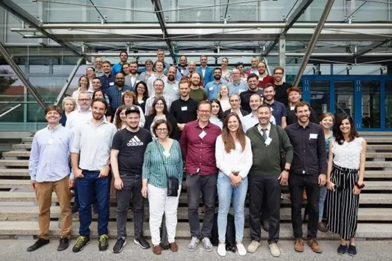
Launched in 2021, OpenSense gathers 110 scientists and experts from 30 European countries. The network is a unique effort to synchronise the work of researchers and stakeholders in the field of opportunistic sensing of precipitation to improve the description, the understanding, and the modelling of the water cycle.
Several individual research projects have laid the scientific groundwork in this field, but no effort has been made to connect and harmonise these individual developments. Opportunistic sensing of precipitation is now at a stage where a research community has to be formed around standardised benchmark datasets and with standardised interfaces for data and knowledge exchange to be able to progress.
“Accurate precipitation monitoring on a large scale is very challenging, but extremely important to help understand and address meaningful challenges such as climate change and water management. OpenSense establishes for the first time a community that develops a new approach for weather monitoring. An approach that can change how we as people will face such challenges in the future”.
Dr Vojtěch Bareš, Chair of OpenSense
Therefore, opportunistic sensing of rainfall or precipitation can greatly improve spatial and temporal resolution of standard monitoring networks on continental scale.
OpenSense COST Action will overcome key barriers preventing data exchange and acceptance as hydrometeorological observations. It will define standards to allow for large-scale benchmarking of opportunistic sensing precipitation products and develop new methods for precipitation retrieval. The network will coordinate the integration of the opportunistic observations into traditional monitoring networks, and finally, it aims to identify potential new sources of precipitation observations.
These coordinated activities will boost the uptake of opportunistic sensing as precipitation observation methods and enable the generation of high-quality precipitation products with unprecedented spatial and temporal resolution.
Additional information
Are you a young researcher or a professional working on hydrometeorological data? OpenSense is organising a Training School this October on new methods for processing opportunistic rainfall sensor data! Applications open in May. Find out more here: OpenSense Training School Tel Aviv.
Follow OpenSense on social media: Instagram, Facebook, Twitter, YouTube